The Land of
Israel
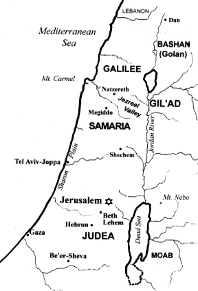
Israel's major regions are: the lush, green Galilee, the infamous Golan Heights, Samaria, Judea, and the Negev, that barren wilderness in the South. Jerusalem is just west of the Dead Sea, nestled in the mountains between Judea and Samaria.
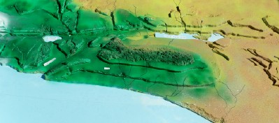
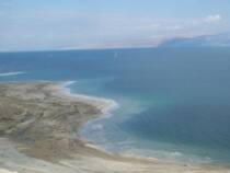
Israel is small--only about the size of New Jersey...Its topography has 4 distinct "belts"--the coastal lowland, called the Plain of Sharon; the Sh'phelah, or foothills; the mountains that form the country's "backbone"; and the Rift Valley, a deep gash that extends from the Jordan River's source in Syria, all the way to southern Africa. It's the lowest place on the earth's surface, far below sea level, and can even be seen from the moon. The Sea of Galilee, the Jordan River, the Dead Sea, and the Reed (Red) Sea are all part of this great rift, which in Hebrew is called the Aravah. (The view below is from the west.)
Yahweh set the land of Israel apart for a very special purpose. As the only place where three continents converge, you could call it the center of the earth--an ideal place from which His instructions could spread worldwide.
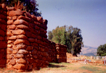
The city of Dan (see photos at left) is a prime example of how it was to work. This outpost thrived at the northern entrance to Israel on the only road from Assyria to Egypt, because of an abundance of water where caravans could stop. YHWH planned it so that all the major trade routes of the ancient mideast had to pass right through this land, so all the world could see the results of the wisdom Yahweh gave them in His special revelation and the lifestyle it entailed. This contact with other nations was meant to spread YHWH's light to them, all too often it let idolatry gain an inroad into Israel instead.
"The Place Where I Have Set My Name"
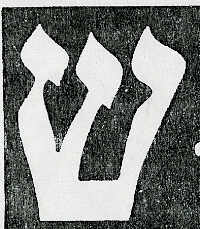
Yahweh told Israel that there was only one place they should come to worship Him with their sacrifices, and He called it "the place where YHWH has chosen to put His name". (Dt. 12:5, 21; 14:24; 1 Kgs. 8:29) This sometimes referred simply to the Temple. But whenever the Jews have wanted to put His name on something (e.g., doorposts or on the phylacteries with which they “bind His words
on their hand" or "between their
eyes", Deut. 6:8,9, or a mezuzah, pictured here, in which His Word
is literally placed upon the doorpost), the name used is Shaddai, often simply abbreviated to its first letter, shiin:
If we'd had a bird's-eye view of Jerusalem before it was built up, we would see that it forms a shiin:
If we look carefully at Genesis 2, it says Yahweh planted a garden east of Eden (not “in Eden”), and a river flowed out of Eden to water it:
"And YHWH planted a garden to the east of Eden ...And a river went out from Eden to water the garden, and from there it was divided and became four heads. The name of the first was Pishon ["spreader"]... The name of the second river is Gihon ["Gusher"]. The name of the third is Chiddeqel [Tigris] (it is the one going east of Assyria), and the fourth river is the Ferath [Euphrates]."
The Tigris and Euphrates are now in Iraq. What is due west of Iraq? Israel! The topography and routes of the rivers certainly changed during the Flood of Noah.
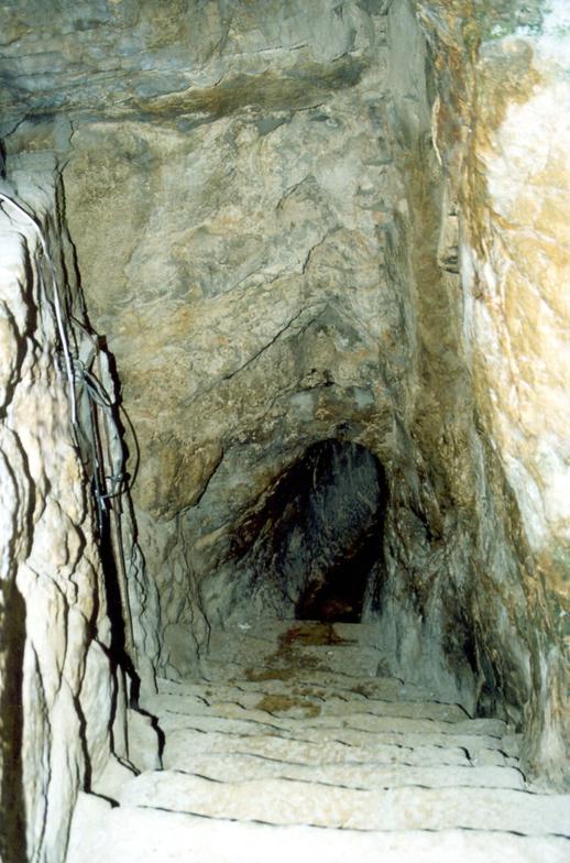
But we do know where
the Gihon's source is: just
outside the part of Jerusa-
lem which was originally
known as Tzion (not the
part called Tzion today).
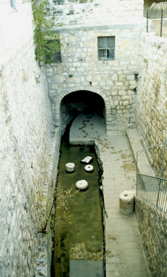
From it ran a natural fissure in the mountain underground. This is how David’s soldiers were able to enter thecity and take it. Hezekiah had the fissure lengthened and widened and all the water channeled to a new reservoir called the pool of Shiloach [Siloam]--an internal water source where healing was found (Jn. 9:7), and helping withstand a siege (as the Holy Spirit can keep us thriving even in dry times-- Jn. 7:38; Ps. 87:7).
It was YHWH's throne from which the river flowed (as it will again, Ezek. 47; Rev. 22, and the Tree of Life will again be there)!
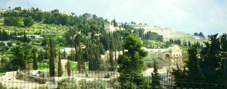
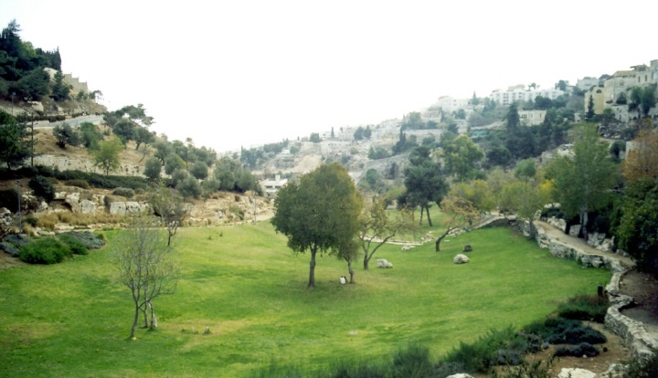
Interestingly, just east of the Eastern Gate of the Temple Mount, on the Mount of Olives, is a garden (pictured at right) where the tikkun (reparation) for Adam and Eve's loss of their garden was accomplished when Y'shua, to the point of his capillaries bursting from the crushing pressure in Gath-shemaney ("Gethsemane", which means an olive oil press) withstood the final test of his resolve to obey YHWH’s will even when it meant his own demise. Could this have been the same place the Tree of Life stood?
Now can you see why Israel is so important to Yahweh?
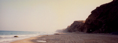
In antiquity, the map was oriented
eastward instead of northward. After all,
“orient” does mean “east”! But the Hebrew word for “east” also means “ancient times” and… “to move forward”. In Scripture,any time one comes to Israel from another place, he is ascending. And here we can see that as soon as one arrives in Israel, he immediately rises to a higher level physically as well! The bluffs that jut sharply up from the beach (see photo) are why this coast is called the Levant—“the lifting up”.
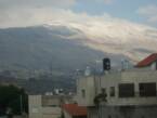
From snow-capped Mt. Hermon, with its ski resort, to lush tropical vegetation, to the desert, to Mediterranean resorts, Israel has been given a little bit of everything—really a microcosm of the whole world.
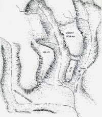
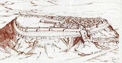
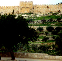
On the Sh'phelah, between the Mediterranean and
the mountains, stood a series of fortress cities
guarding the only route by which Jerusalem could be
easily attacked.
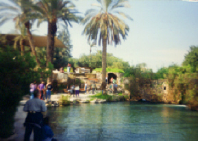
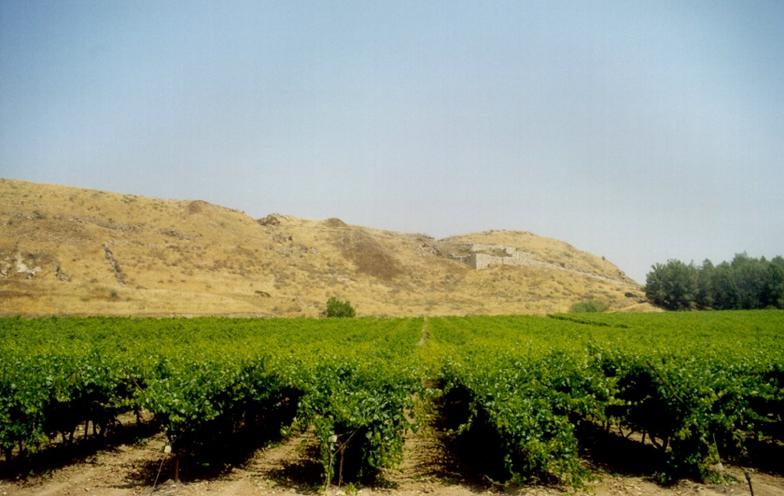
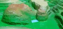
Lachish (pictured at right) was the strongest of them all--a majestic city with lush vineyards then as now. It "plugged"
the entrance to the important city of Hevron. From Lachish
you can easily see the tels of Azekah and Maresha, and
they sent warnings from one fortress to another with light signals. But since Lachish had been "the beginning of sin to
the daughter of Tzion"--a foot in the door for idolatry to
spread throughout Israel --even it had to fall.
World-scale geological processes affecting Israel
The Jordan Valley apparently used to extend all the way into the Gulf of Aqaba (the right branch of the Red Sea; see map of the ancient Near East.) A different orbit that Mars held until 701 B.C. (often crossing earth's path quite closely) served as the cause of a series of several later biblical catastrophes like an axis wobble that in some locations could make the sun appear to stand still (Joshua 10; Isa. 38:8).
A Brief History of Geology
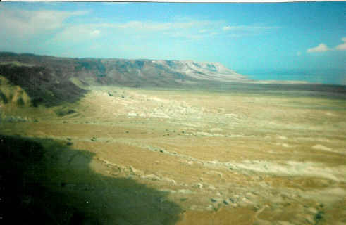
It also opened the Great Rift (seen at left) so that Sodom and Gomorrah's valley sank
into it when the equatorial bulge had to shift position so rapidly that it simply tore a
gash in the earth's surface that spans a full 50 degrees of latitude. (Patten, Hatch, and
Steinhauer, The Long Day of Joshua and 6 Other Catastrophes, Seattle: Pacific Meridien,
1973; Donald Patten, The Biblical Flood and the Ice Epoch, Pacific Meridien, 1966; Patten,
Catastrophism and the Old Testament, Pacific Meridien, 1988) It released volcanic proces-
ses to act on the petroleum tar and sulfur that were in the area and caused what was
probably a nuclear-scale blast. The 1,300-foot deep crater effectively blocked the
outflow of the Jordan and the minerals and natural salt reserves built up to make it so salty that nothing can live in it. Volcanic ash is still visible at the tel of Beth She'an, though there have been no active volcanoes here for centuries.
Another important problem is solved when we consider such cataclysmic geophysical changes. Archaeologists have found that while the Second Temple faced due east, the first, Solomon's was aligned 6.2 degrees north of due east. The first Temple was built before the Mars encounter in 701 B.C., the second after it. Computer simulations of that event suggest that there may have been about a 6.5-degree rotation in the earth's axis. In other words, there was actually a change in what was due east between the constructions of the two temples. (Don Stewart and Chuck Missler, The Coming Temple. Orange, CA: Dart Press, 1991)
This would also explain why a land "flowing with milk and honey" is so barren today. Part of this, of course, was accomplished by overgrazing by sheep as well as deforestation. The Romans cut down all the trees on the Mount of Olives (though many grew back from the same roots), and when the Turks ruled the land they taxed people according to how many trees were on their land. So many cut their own trees down, causing major erosion.
But a shift of 6 to 6.5 degrees would have changed the climate of Israel from one paralleling northern California to one very much like that of southern California. It is definitely the latter now. Northern California is where the redwood trees grow, and this could explain why the cedars of Lebanon grew so large when today they are few and, while large, do not break world-class records. In other words, at the time of the conquest under Joshua, Israel would have been so lush that other nations would fight for it. We can see examples in the huge cluster of grapes found in the Valley of Eshkol.
The Israelis have accomplished some impressive re-agriculturalization through irrigation and other ingenious methods, but nothing like that! This may suggest what the now not-as-attractive land will be like in the Kingdom--the "time of the restoration of all things".

Not So Mystical After All
The Lake of Fire
Globs of petroleum tar from
deep beneath the Dead Sea
used to rise to the surface
and be ignited by lightning,
so it was actually called the
“lake of fire”. An earthquake
in 1840 sealed off that
seepage.
Seismic activity has recently restarted in the area, and another earthquake when the Messiah sets his foot on the Mount of Olives may be what opens it back up, allowing the Counterfeit Messiah to be literally thrown alive into the Lake of Fire!
"Gehenna"
The westernmost valley
in Jerusalem, Gey-Hinnom,
divides the new city from the old. old. In Greek it was known as
Ge-henna. Used as a rubbish
dump because infant sacrifices had made it unworthy of nobler
use, fires were kept burning there day and night to burn it up. So Yeshua is not talking about a Dante-style "hell" when he mentions its fires. It was an idiom for a place to dump things that were no longer salvageable. (Notice that
the Jews have even made hell beautiful!)
The Valley of the Shadow of Death
This is a nickname for the Qidron Valley,
since it was the only place in Jerusalem
not illuminated by the four great lights in
the Temple at the feast of Sukkoth. David
had to cross over it when he had to flee
Jerusalem during Avshalom's revolt. Yeshua's
impending death also weighed heavily upon
him right in that valley. Exodus 27 specifies that only pure olive oil, given willingly at the first crushing, can be used to light the lamps in YHWH's
sanctuary. The place Yeshua said “not my will but Yours be done”, Gath Shemen (which very appropriately means "an oil press”), was in this valley as well.
Visit by
Google map
below...